MM Tirion
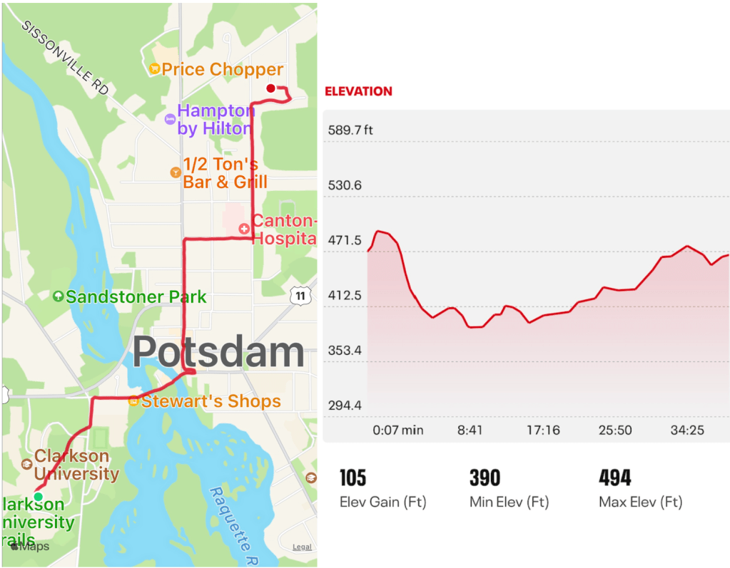
Someone suggested that the village of Potsdam lies in a bowl, i.e. is more low-lying than surrounding regions. I could find no interactive online tools to confirm this, either as 3d maps or 2d contour maps. But nifty phone apps that map our walks do! In these two screen shots, for example, is the walk from the Science Center on Clarkson Hill to Circle Dr, both as a street map as well as an elevation map. The highest points on the hill campus are at over 470 feet elevation, with a quick descend to the bottom of the bowl at around 400 ft elevation along the river. Walking along Market St to Cottage, the elevation remains at a depressing 410 ft, before beginning a slow ascent along Leroy St towards the edge of the village. It would be fun to see other cross-sections posted, perhaps along Canal St to Stevie’s Trail, which I discovered yesterday to be a lake before the stadium was constructed.
These low-lying regions create problems during rainy and snow melt seasons, as yards turn into swamps and sometimes basements too in the lowest-lying areas. Another surprising consequence of this bowl is that our police cars need to be outfitted with repeaters to strengthen radio signals from more distant points in the village. That is on top of the regional challenge of providing reliable emergency radio communication throughout the county. In fact, SLC legislators just finalized a contract with Motorola to built 19 towers in SLC to provide 95% portable coverage for emergency services throughout the county, with one of those towers to be placed in Potsdam’s bowl, in the lot adjacent to the Lowes.
